


Sellers Precinct, Lincoln County, Nebraska
About
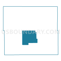
Outline

Summary
| Unique Area Identifier | 613572 |
| Name | Sellers Precinct |
| County | Lincoln County |
| State | Nebraska |
| Area (square miles) | 181.18 |
| Land Area (square miles) | 178.95 |
| Water Area (square miles) | 2.23 |
| % of Land Area | 98.77 |
| % of Water Area | 1.23 |
| Latitude of the Internal Point | 40.95222310 |
| Longtitude of the Internal Point | -100.78296300 |
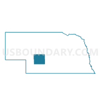
Maps

Graphs
Select a template below for downloading or customizing gragh for Sellers Precinct, Lincoln County, Nebraska


Neighbors
Neighoring Voting District (by Name) Neighboring Voting District on the Map
- Hershey Precinct, Lincoln County, NE
- Medicine Precinct, Lincoln County, NE
- Osgood Precinct, Lincoln County, NE
- Wallace Precinct, Lincoln County, NE
Top 10 Neighboring County Subdivision (by Population) Neighboring County Subdivision on the Map
- Osgood precinct, Lincoln County, NE (1,950)
- Hershey precinct, Lincoln County, NE (1,674)
- Sellers precinct, Lincoln County, NE (968)
- Wallace precinct, Lincoln County, NE (668)
- Medicine precinct, Lincoln County, NE (322)
Top 10 Neighboring Unified School District (by Population) Neighboring Unified School District on the Map
- North Platte Public Schools, NE (28,794)
- Hershey Public Schools, NE (2,216)
- Medicine Valley Public Schools, NE (1,356)
- Maxwell Public Schools, NE (964)
- Maywood Public Schools, NE (871)
- Wallace Public School District 65 R, NE (803)